A powerful storm has hit the eastern United States, bringing dangerous floods, road closures, and emergency evacuations. At least one person has lost their life, and thousands are facing severe weather conditions.
One Dead in Kentucky as Floodwaters Sweep Through

In Kentucky, a 73-year-old man from Manchester was killed when he stepped out of his car and was swept away by fast-moving floodwaters. The Clay County Coroner’s Office confirmed the tragic incident, which occurred in the Horse Creek area late Saturday night.
Meanwhile, flash flood warnings were issued across multiple states, including Kentucky, Virginia, West Virginia, Arkansas, and Tennessee. Officials warned that the floods could cause serious damage, with over 400,000 people in Virginia alone facing potential danger.
Tornado and Power Outages Add to the Chaos

On Saturday evening, tornado warnings were in effect for parts of Mississippi, Tennessee, and Arkansas. A larger tornado watch was also issued for Mississippi and Alabama, lasting into the overnight hours.
Severe weather has also caused power outages. More than 19,000 homes and businesses in Virginia lost electricity, while over 16,000 outages were reported in Kentucky and Louisiana.
Virginia Governor Urges Residents to Stay Safe
Heavy rain continues to pour across Virginia, causing flash floods, particularly in the southwest. Governor Glenn Youngkin reported that between 1.5 and 3 inches of rain had already fallen, with more expected.
“Do not fight the water. Just leave and call for help,” Youngkin advised residents in a message posted online.
Authorities are urging people in flood-affected areas to evacuate immediately. Emergency teams, including first responders, law enforcement officers, and the Virginia National Guard, are working to protect public safety.
Floodwaters Close Roads and Force Evacuations in Kentucky
Kentucky has been one of the hardest-hit states. Rising waters forced the closure of Kentucky Route 160 in Knott County due to a landslide. In Perry County, some homes had to be evacuated, while floodwaters in Hardin County reached historic levels.
In Jackson, a city already dealing with serious flooding, emergency teams rushed to evacuate residents near the overflowing 75-acre Panbowl Lake. Among the facilities evacuated were a hospital and a nursing home.
Governor Andy Beshear urged Kentuckians to take the flooding seriously.
“We are seeing dangerous flooding across the state. Please stay informed and be ready to move to higher ground if needed,” Beshear warned.
Kentucky Declares State of Emergency as Flooding Worsens
Ahead of the storm, Governor Beshear declared a state of emergency on Friday. Temporary shelters have been set up for those forced to leave their homes. Kentucky State Police are also conducting wellness checks to ensure the safety of residents.
By Saturday afternoon, streets in many Kentucky towns were already underwater. Parks turned into lakes, and floodwaters kept rising. Some areas received 2 to 4 inches of rain, with more expected.
The City of Bowling Green also warned residents about worsening conditions.
“Our storm sewer system is working at full capacity. If you don’t have to travel, please stay home to keep yourself and others safe,” city officials announced.
Emergency Rescues and Road Closures Across the State
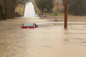
Several cities in Simpson County reported floodwaters covering major roads. Emergency workers had to push a stalled vehicle out of the water. As conditions worsened, officials put up road closure signs and barricades to prevent accidents.
In Manchester, emergency teams carried out multiple water rescues, the local police reported. Elsewhere in Kentucky, dozens of roads were completely flooded and closed in Adair County.
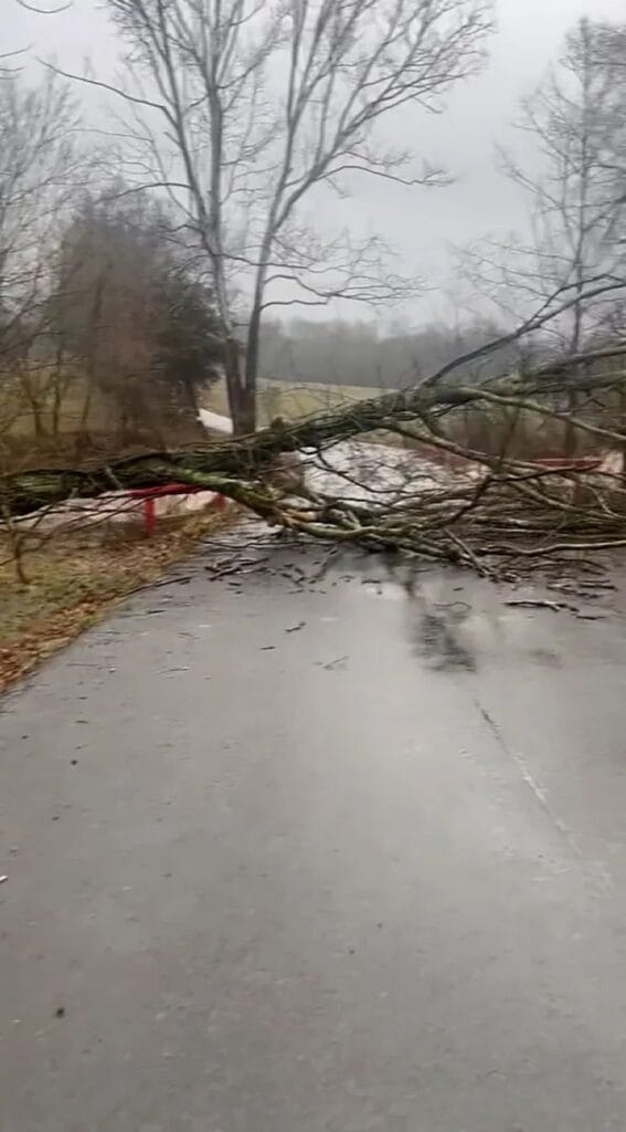
The Kentucky Transportation Cabinet also warned of additional dangers, including fallen trees and rockslides caused by the heavy rain.
Kentucky Residents Fear Losing Everything Again
For many in Kentucky, this flooding brings back painful memories. Just two years ago, devastating floods killed 43 people and left many communities in ruins.
Homes were destroyed, cars were washed away, and businesses were lost. Thousands of residents were displaced, forced to rebuild their lives from scratch.
Danny Laferty, a resident of Knott County, still remembers the heartbreak of losing his home in 2022. Now, he fears history is repeating itself.
“It was horrible. We had mud six inches deep in our house,” he recalled. “I’m so nervous we’re going to lose everything again.”
Laferty is still fixing his flood-damaged home from the last disaster. He evacuated with his wife, grandchildren, and dogs, but the emotional toll remains heavy.
“It’s tough on my wife. It’s tough on me too,” he said. “So much hard work and pain.”
Though he has lived in the area for years, Laferty believes the flooding in recent times is different.
“I don’t understand why it’s getting this bad,” he said.
A Potentially Historic Flooding Event
This massive storm has already flooded parts of California. Now, it is hitting the eastern U.S. with heavy rain, thunderstorms, possible tornadoes, and even snow.
Snow is falling over the Great Lakes, while areas further south, such as the Ohio Valley and Mississippi Valley, are experiencing severe thunderstorms.
The storm is expected to intensify overnight into Sunday before weakening on Monday. However, lake-effect snow could continue in the Great Lakes region even after the main storm passes.
Rainfall is the biggest threat. Some areas could see more than 2 inches of rain, while others may get much more.
Weather officials have classified this as a level 4 flood risk, the highest on the scale. Over 1.5 million people in western Kentucky and northwestern Tennessee are at risk of “life-threatening and severe flooding.”
A level 3 flood risk extends over 500 miles from eastern Arkansas to West Virginia, putting millions more in danger.
“This could be a historic flash flood event,” the National Weather Service in Paducah, Kentucky, warned.
The rain started early Saturday and triggered flood warnings in Tennessee and Kentucky. By the afternoon, flooding had already become severe.
Rare and Deadly Flooding Events
Flooding events of this magnitude are extremely rare. According to the Weather Prediction Center, warnings like this are issued on fewer than 4% of days each year. However, these events are responsible for 80% of flood-related damage and 40% of flood-related deaths.
Meteorologists say the storm system is “very unusual for mid-February.” In some places, rainfall rates could reach 2 inches per hour, leading to extreme flooding.
Because the ground is already saturated from recent storms, the flooding is expected to be even worse than usual.
Severe Thunderstorms and Tornadoes
To the south, powerful thunderstorms are developing. A level 3 severe storm risk is in place for Louisiana, Arkansas, Mississippi, Tennessee, and Alabama.
Strong winds and tornadoes are expected, with Mississippi at the highest risk for EF2 or stronger tornadoes. These tornadoes can cause severe damage, tearing roofs off buildings and shifting homes from their foundations.
The situation is especially dangerous because some of the strongest storms will happen at night. It is much harder to spot tornadoes in the dark, making them twice as deadly as daytime tornadoes.
Just last week, a nighttime tornado in Tennessee killed at least two people.
More Snow and Ice on the Way
While rain and storms batter the southern and central U.S., the northern regions are dealing with snow and ice.
Snow is falling over the Great Lakes and Northeast, while icy conditions are spreading in the Ohio Valley. Later on Saturday, the snow is expected to turn into a mix of sleet and freezing rain.
This messy winter storm will hit New York and New England the hardest overnight and into Sunday.
Strong winds could also knock out power in areas experiencing snow and ice, making travel dangerous.
By the end of the weekend, some regions could see over a foot of snow, especially in the Great Lakes, northern New York, and New England. Areas with ice and sleet may receive slightly lower snowfall totals.
Frigid Temperatures to Follow
Once the storm passes, another blast of bitterly cold air will move across the U.S. Early next week, parts of the country could experience temperatures 30 degrees below normal.
As the eastern U.S. recovers from the storm, residents will have to brace for even more extreme weather.


